| The old track between Farafra and Dakhla, the Darb el-Farafra, ran across an area of the desert covered by sand dunes, where driving a motor vehicle is extremely difficult. The modern road runs west of the old route and, if coming from north, offers an amazing view of the descent from the plateau into the depression of Dakhla. | |
| Dakhla Lies at N25 28 and N 25 44 Latitude and E 28 48 and E 29 21 longitude. Located 120 kilometers (75 miles) west of Kharga, Dakhla, at 410 square kilometers (256 square miles), shares the same northern escarpment as its eastern neighbor. The scarp runs for 200 kilometers (125 miles) east-southeast to west-northwest along the northern edge of both depressions. The 300 to 400 meter(960 to I,280 foot) high scarp is composed of a top layer of white chalky limestone followed by a mid-section of “greenish and ash-grey leafy clays” (the terms used by Rolfs) and has a base of brown and black beds containing gypsum and scattered deposits of fossils. In fact, there are fossils and bone beds throughout the oasis. Between the scarp and the cultivated areas from Qasr Dakhla in the west to beyond Tineida in the east is the Sioh Ridge, a 2 to 3 meters (6.4 to 9.6 thick dark-brown bone bed of fish, fish teeth, bones, and vertebrae. These bone beds create phosphate, which is used as fertilizer. Other minerals found in the area include ocher, cobalt, nickel, salt, and barites. There are also black and red clays, the latter containing iron oxide. Most of the mud brick buildings in the oasis are tinged with the red of iron oxide. | |
| The escarpment, which is eroding in a northerly direction, helps to break the harsh winds, allowing for rich agricultural development along the floor of the depression it has a number of bays, one near Qasr Dakhla at Bab al-Qasmund where the Darb al-Farafra exits the oasis, one northeast of Balata where the Naqb Balata leaves the depression, and another east of Tineida where Naqb Tineida leads up the cliffs of the Abu Torture Plateau to the Darb Ain Amur. | |
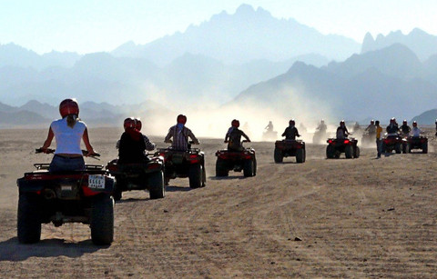
| The northern escarpment is the major cliff in Dakhla. The eastern part of the oasis is open to Kharga, the west is blocked, not by a cliff but by the massive dunes of the great Sand Sea, and the south drops over a minor escarpment and then runs free and clear for hundreds of kilometers past the Gilf Kebir and into Sudan. Higher than Kharga, the lowest point in Dakhla is 100 meters (320 feet) above sea level. More fertile than Kharga, 45 percent of the total area is under cultivation. | |
| Like other oases, there is evidence that Dakhla was inhabited since prehistory, but unlike all the others, here significant remains dating to the Old Kingdom have been found. The archaeological remains unearthed at ‘Ayn Asil in the last twenty years suggests that this oasis must have played an important role under the VI Dynasty of the Egyptian kings. Placed at the junction between the track called Darb el-Tawil, leading directly to Middle Egypt, and the two caravan routes which via Kharga gave access to a number of tracks to Upper Egypt, ‘Ayn Asil was originally a small square fortified enclosure. During the reign of Pepi II, the Governors of the oasis built a large palace and obtained the permissio There is evidence to suggest that Dakhla has been inhabited since prehistory and maybe as long s 200,000 years ago. Recent studies carried out the Canadians indicate that the ancient inhabitants suffered from arthritis, tuberculosis, and iron deficiency anemia. The average life expectancy of men was twenty-four, while women lived to be around thirty-seven. | |
| In 1819, the population of the entire oasis was estimated at between five and six thousand. Cailliaud found the people of Dakhla to be much more friendly and curious about Europeans that those of Kharga, Bahariya, and Siwa. They were more willing to show him around. Today’s population is an amalgam of peoples who have traveled to the oasis through the ages. There are elements of Libyan, Nubian, and Sudanese heritage, but mainly the people are Berber and Bedouin. Among themselves they make distinctions from village to village: al-Mahub is of Sansui origin; Balata and Tineida is Moroccan; Qasr is Saudi Arabian; Qalamun, Turkish, and Mut are Asyuti and Bedouin. Sheikh Wali is considered a new village populated by the people from Gedida. |
|
| As in the entire in oasis in the Western Desert, people marry within the extended family. Although patterns vary, educated men marry at twenty-five to thirty and uneducated men at twenty to twenty-five. Women marry at a younger age. The head of every village must be invited to every wedding (and when someone dies, each village must send a representative). Life expectancy for men in the oasis today is sixty to seventy-five, for women seventy-five to eighty. | |
| When problems arise in a family, the eldest man still makes the decisions. If the dispute cannot be solved within the family, then the matter is brought before the mayor of the town. Police are never involved in these matters. This type of discipline can only work if there is respect among relations. Today, the villages retain many distinctions, even in dialects. At Qasr they pronounce the I like an n, saying Unna for Ulla, the water jug. In Tineida, they use the classical “Qaf.” In Asmant ei as in ‘bay” is pronounced “oy” as in “joy,” so “Enti fein?” (Where are you?) Is pronounced “Enti foyn?” |
|
Dakhla Oasis
© Copyright 2015 LaPerla Travel Developed by Prominds : promindsco.com